Via Flaminia Rome: Ancient Road from Piazza del Popolo to Ponte Milvio
Via Flaminia Rome is one of the best ways to understand Rome as a living archaeological landscape rather than a collection of isolated monuments. The ancient road linked the city with Umbria and the Adriatic corridor, ultimately reaching Ariminum (modern Rimini), and its line still shapes modern streets, neighborhoods, bridges, gates and archaeological sites.
This 2026 guide explains where the Via Flaminia ran, why it mattered, what survives today and how to trace the most interesting sections without turning the day into a transport marathon. Some monuments along the route have limited access, restoration closures or special-opening schedules, so use the official source linked below shortly before visiting.
Via Flaminia Rome at a glance
| Built | 220 BC under censor Gaius Flaminius |
| Direction | North from Rome toward Umbria and the Adriatic |
| Historic city gateway | Porta Flaminia, now Porta del Popolo |
| Key bridge | Ponte Milvio |
| Further Roman stop | Malborghetto on the northern Flaminia |
| Best for | A walk combining ancient infrastructure with modern north Rome |
Why the Via Flaminia matters
The Via Flaminia was one of the great strategic projects of Republican Rome. Built in 220 BC under the censor Gaius Flaminius, it connected the capital with the Apennine passes, Umbria and the Adriatic side of Italy. This made it essential for military movement, trade and the political integration of central Italy.
Unlike roads that survive mainly as isolated archaeological parks, the Flaminia remains a powerful urban axis. Piazza del Popolo, Via Flaminia, Ponte Milvio and the northern suburbs all sit on or near a corridor that has carried movement for more than two millennia. Modern traffic can hide that continuity, but it also proves the route’s lasting geographic logic.
The road’s most famous historical association is the Battle of the Milvian Bridge in AD 312, when Constantine defeated Maxentius. The battle reshaped imperial politics and later Christian memory. Yet the road mattered long before Constantine: armies heading north, officials traveling to provincial towns and goods moving toward the Adriatic all used the same corridor.
Beyond Ponte Milvio, the Flaminia continued through Saxa Rubra and toward the site now known as Malborghetto, where a Roman quadrifrons monument was later incorporated into a medieval and early modern casale. Following these successive layers is one of the pleasures of the road.
Where the ancient road ran
In the imperial city, the Flaminian approach entered through Porta Flaminia in the Aurelian Walls, the gate now transformed into Porta del Popolo. The road then ran north through the area that still carries the name Via Flaminia.
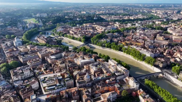
Ponte Milvio carried the route across the Tiber. The surviving bridge includes ancient fabric beneath later reconstructions and remains one of the most important crossings in Rome’s northern geography.
North of the bridge, the ancient road continued toward Prima Porta, Saxa Rubra and Malborghetto before crossing the Apennines. Travelers can sample this wider landscape by public transport or car, but the central-to-Ponte-Milvio stretch is the most practical self-guided section.
Roman roads were not immutable lines drawn once and preserved forever. Approaches to the city changed when walls, bridges and gates were rebuilt; later roads often shifted a few meters from the ancient alignment; medieval and modern construction reused paving and masonry. For visitors, the goal is therefore not to imagine that every modern lane sits exactly on Roman basalt, but to recognize a corridor that remained strategically important for centuries.
Best places to trace the road today
Porta del Popolo
Begin at the monumental gate on Piazza del Popolo. Its current appearance owes much to later architects, but the location preserves the function of Rome’s northern entrance. Standing here, imagine travelers arriving from Umbria and northern Italy before dispersing into the city.

Via Flaminia through the Flaminio district
The modern road is busy, yet its continuity is archaeologically important. The district mixes 20th-century architecture, museums and sports venues with the line of one of Rome’s oldest strategic roads.
Ponte Milvio
Ponte Milvio is the essential stop. Rebuilt in stone in the late Republic and repeatedly repaired, it controlled the Tiber crossing for travelers on the Flaminia, Cassia and other northern roads. The bridge is pedestrian-friendly today, making it much easier to appreciate than many road monuments.
Oasi di Ponte Milvio archaeological remains
Recent works near Ponte Milvio have revealed and preserved elements associated with the ancient riverbank and a section of Roman Flaminia paving. These finds are a reminder that archaeology continues beneath modern infrastructure and that even familiar neighborhoods can produce new evidence.
Malborghetto
For a deeper excursion, continue north to the Casale di Malborghetto. The building incorporates a late Roman four-arched monument traditionally associated with Constantine’s campaign before the Battle of Ponte Milvio. It is one of the most striking examples of a Roman monument transformed into a later building.
A practical self-guided route
1. Start in Piazza del Popolo
Examine Porta del Popolo, then look south toward the historic center and north along the Flaminian axis. This is a rare place where urban planning makes the direction of an ancient road immediately understandable.
2. Walk or ride through Flaminio
Continue north along Via Flaminia. If traffic makes the road unpleasant, use tram or bus connections for part of the stretch and save your walking time for the bridge area.
3. Explore Ponte Milvio
Cross the bridge slowly, look at the river landscape and compare the ancient strategic crossing with the modern social neighborhood around it.
4. Look for recent archaeological interpretation
Check the riverfront park and any accessible displays or preserved remains around the Oasi di Ponte Milvio. Works and access conditions may evolve, so treat this as a flexible stop.
5. Optional: continue to Malborghetto
If you have a car or are comfortable with suburban transport, extend the route north. Malborghetto transforms the road guide into a half-day study of how Roman monuments were reused in later centuries.
Allow roughly 3–4 hours for Piazza del Popolo to Ponte Milvio, longer with Malborghetto for the core route. You can shorten it by choosing only the first two or three stops, or expand it into a full day by adding the nearby museums, churches and parks mentioned in the internal links. The route is more enjoyable when you leave time to look at the urban fabric instead of treating every stop as a checklist item.

How to read what survives
On the Flaminia, continuity is more important than spectacular ruins. The modern road corridor itself tells the story: city gate, river crossing, northern approach and suburban extension remain aligned because the geography still demands a similar route.
Bridges deserve special attention. Roman roads were only as effective as their crossings, and Ponte Milvio’s strategic significance came from controlling movement over the Tiber. Later armies repeatedly fought for the same point because the ancient engineers had chosen the logical crossing.
At Malborghetto, look for architectural reuse. A Roman commemorative monument became part of a fortified and residential structure, showing how useful masonry was adapted rather than abandoned.
Practical visiting information for 2026
| Best starting point | Piazza del Popolo |
| Main bridge stop | Ponte Milvio |
| Core outdoor cost | Free |
| Public transport | Metro A to Flaminio, then tram/bus or walking |
| Optional excursion | Malborghetto on the northern Via Flaminia |
The central route is easy to organize because most of the experience is outdoors. Piazza del Popolo and Ponte Milvio do not require tickets, and the Flaminio district has abundant cafés, toilets and public transport.
The weakest part for pedestrians is the traffic-heavy modern road between the most attractive nodes. There is no benefit in forcing yourself to walk every meter. Using a tram or bus for the less pleasant section actually produces a better historical visit.
Malborghetto is a specialist extension rather than an essential first-time stop. Check the relevant official information for opening conditions before making a special trip.
For the latest access information, check the official Turismo Roma page for Ponte Milvio. Official pages are especially important for monuments that open only on selected dates, require guided access or may close temporarily for conservation work.
How to get there and move between the stops
Metro A to Flaminio is the simplest start. From there, walking north is possible, but public transport along the Flaminia can shorten the route.
Ponte Milvio is well connected by buses and is surrounded by a lively neighborhood. It is also a good endpoint because you can eat or take a break before returning to the center.
For Malborghetto, a car is more convenient than public transport for most visitors. If you are not driving, check current bus and regional connections carefully before committing to the extension.
What to see nearby
Combine this route with Piazza del Popolo, Ponte Milvio and the Flaminio neighborhood guide. These pages add art, architecture and practical stops without sending you across the city.
Photography tips
Ponte Milvio is strongest early in the morning or late in the day, when the bridge, river and Valadier tower can be framed without heavy crowds. In Piazza del Popolo, use the obelisk and gate to show the road’s urban axis. Ancient road sites often look modest at first glance, so side light, a human figure for scale and a wider view that includes the modern city can tell the story better than a tight photograph of masonry alone.
At roadside monuments, never step into traffic lanes or climb barriers for a photograph. A telephoto lens or phone zoom is often safer and more useful than trying to stand directly beside a monument that was never designed as a modern visitor attraction.
Accessibility and comfort
Piazza del Popolo and Ponte Milvio are largely paved and relatively straightforward, although cobbles can be uncomfortable for wheelchairs or strollers. Sidewalk quality varies along Via Flaminia, and the Malborghetto extension requires more planning.

Carry water in warm months, wear shoes with reliable grip and avoid assuming that a short distance on the map will be comfortable in summer heat. Rome can be demanding in July and August, while heavy rain can make park paths muddy and expose uneven paving.
Common mistakes to avoid
- Walking the entire modern Via Flaminia beside heavy traffic simply to say you followed the road.
- Treating Ponte Milvio only as a nightlife area and missing its strategic history.
- Confusing the modern monumental gate with a completely untouched Roman structure.
- Adding Malborghetto without checking current opening conditions.
- Trying to combine the route with distant southern-Rome archaeology on the same day.
FAQ about Via Flaminia Rome
When was the Via Flaminia built?
The road was built in 220 BC under the censor Gaius Flaminius, although some local routes it used may have older origins.
Can you walk the Via Flaminia in Rome?
Yes, especially between Piazza del Popolo and parts of Flaminio, but using public transport for busy sections makes the visit more pleasant.
Is Ponte Milvio Roman?
The crossing is ancient and the bridge has Roman origins and surviving ancient fabric, but it has been repaired and modified many times over the centuries.
Is the route free?
The core outdoor route is free. Museums or special-access sites along the corridor may have separate tickets.
Is this worth doing on a first trip?
Yes if you have already planned the major central sights and want a half-day that mixes archaeology with a living neighborhood. Otherwise, prioritize the Colosseum, Forum and Vatican first.
Final tips
The Via Flaminia is valuable precisely because it never stopped being a route. From Porta del Popolo to Ponte Milvio, the ancient logic survives beneath a modern city that still moves north along the same corridor. Follow the gate, the street and the river crossing in sequence, and Rome’s geography becomes far easier to read.